
In the backcountry of the French Alpes-Maritimes, the Rocher des Baus in La Tour sur Tinée has become a must-visit in recent years for adventurous climbers on sandstone terrain.
The digital topo guide for the Rocher des Baus, available in the OmegaRoc app, now integrates geolocation on photo with Veezer to make it easier to locate access points and sectors at the climbing site.
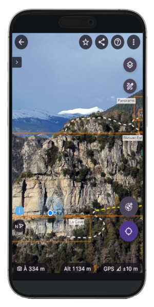
Geolocation on photo on the Rocher des Baus with Veezer, with location accuracy down to a few meters
The site’s topo guide, which is essential, was created by route setter Lionel Catsoyannis and published exclusively in digital format in the OmegaRoc app.
The digital format, which facilitates updates, is particularly relevant here as the site is constantly evolving, with many new routes having been established since its creation.
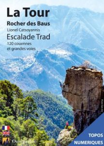
Digital topo guide for the Rocher des Baus
The site of the Rocher des Baus has a complex topology: sectors are spread across two orientations and multiple levels, some access points are via ledges, the vegetation is sometimes dense, and rock bars are omnipresent. By providing overview images of the topo in the Veezer app, geolocation on photo allows users to navigate the site more easily, immediately identifying access points and sectors.
This new feature, developed in partnership with OmegaRoc, is a first for the publisher. It is also an opportunity to test how climbers receive the functionality and gather user feedback.
The experience will soon be extended to other topo guides.
OmegaRoc is the specialist in ethical climbing topo guides, a pioneer in digital climbing topos, offering guides for over 800 crags (single-pitch and multi-pitch routes) in France and abroad.