The Volopress Toponeige collection offers 15 guidebooks dedicated to ski touring, with encyclopedic descriptions of routes across the various massifs of the Western Alps, featuring several thousand itineraries and variations—from beginner outings to very steep slopes. The result of decades of mountain excursions by a team of passionate experts!
Cover of the Ecrins Est guidebook
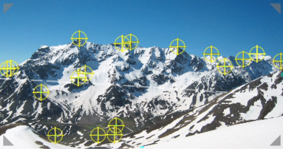
For each itinerary, the guidebooks rely on scouting photos taken from optimal viewpoints, on which the routes have been carefully traced.
Flipping through a Volopress ski touring guidebook makes one thing clear: the photos provided are perfect for spotting the routes, and the database is enormous, with near-comprehensive coverage of the massifs.
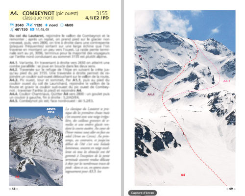 Preview of a route in the guidebook
What if we integrated these photos into the Veezer app? 😊
The project: Extract the photos and routes from the guidebooks and integrate them into the Veezer app to enable geolocation on the photos during outings.
A proof of concept was developed in collaboration with the Volopress team on the Combeynot slope near the Col du Lautaret (05), using photos and routes extracted from the Ecrins Est guidebook.
The original photos were extracted from Volopress archives. The shots come from a wide variety of sources: different years, cameras, zoom levels, digital photos, or scanned analog photos. A real challenge for georeferencing! 😊
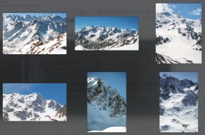
The original photos
Georeferencing was carried out by taking control points from various cartographic sources, often with no information about the viewpoint.
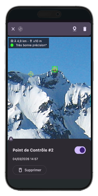 Acquiring control points for georeferencing in the Veezer app
Finding reference points is not straightforward, especially for close-up views. However, by multiplying the control points, we achieved excellent results. All selected photos were successfully integrated. The preparation time remained very reasonable compared to the effort required to acquire the scouting photos.
Example of control points used for georeferencing a photo
The routes and annotations were then traced onto the photo in the app based on the guidebook’s routes, respecting the graphic charter.
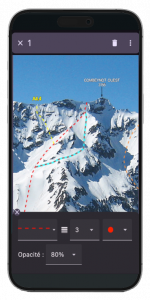
Tracing routes and annotations in the Veezer app
The result: Full-resolution guidebook photos in the Veezer app, with geolocation on the image and route display.
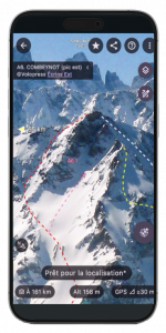
Example of a guidebook route photo visualization in the Veezer app
A field test was conducted in the area by the Volopress team (thanks, Victor!) with the participation of various group members. The test proved successful in terms of geolocation accuracy and the added value of photo-based geolocation during the outing!
See the outing: COMBEYNOT (West Peak), Classic North, 03-13-2026
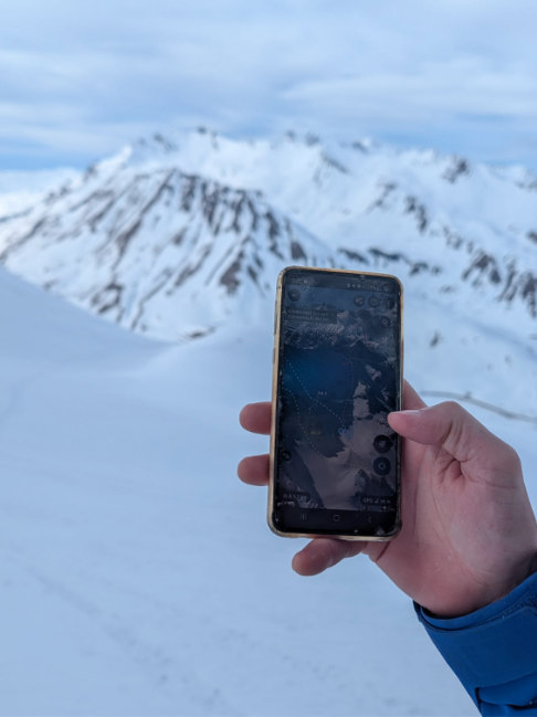
Using Veezer in the field (© Volopress VIC)
![]()
Geolocation on photo and GPS track display
Several areas for improving the app were identified and addressed after the test: infographics (custom trace colors, text formats), legends and links, protection of published content, watermarks, etc.
Next steps: Open the test to practitioners by publishing the prepared photos, train the Volopress team to independently prepare photos, produce more zones, and find the best way to make the photos accessible to practitioners to extend the experience of the printed guidebook!