A selection of drone photos from the Alpes-Maritimes climbing guidebook has been integrated into the Veezer app to create a proof of concept for sector localization, complementing the traditional paper guidebook.
For this test, overview shots of some iconic climbing areas in the Alpes-Maritimes were included (such as Baou de Saint-Jeannet, La Turbie, etc.):
- Import and georeferencing of drone photos provided by the author (using control points on IGN maps or aerial imagery within the Veezer app).
- Overlay of the guidebook’s infographics in the Veezer app (sector locations and access routes).
- Field testing to validate the solution.
The result: Comprehensive views of climbing sites, combining sector mapping and access routes, with real-time location tracking on the image.
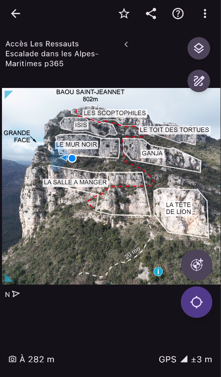
Overview of the climbing site in the Veezer app
In the field, being able to pinpoint your location within a few meters on the photo—complete with sector mapping and access routes—is a real game-changer. This feature seems particularly well-suited for complex sites, such as the tiered cliffs of Baou de Saint-Jeannet, or for locating the starts of multi-pitch routes
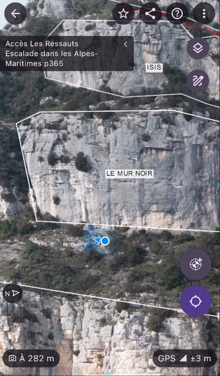
Zoom and real-time location in the Veezer app
On vertical or steep terrain, oblique or horizontal photos (taken from the opposite slope or by drone) provide an unmatched level of detail—offering real added value compared to traditional cartographic data.
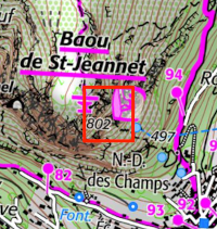
Locating the site on the 1:25,000 IGN map… we could use a little more detail to find our way!
A special thanks to Olivier du Chastel for providing the drone photos with sector mapping (Topo Escalade des Alpes-Maritimes – Editions du Pélago, 2025).