A day of mountain testing full of learning!
The Outing
Sanguinère-Sanguinerette (Northern Mercantour), departure from Estenc, 03/12/2026
with Alain, Michèle, Jean-Séb, and David
Before the Outing
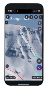
Preparation of the route, georeferencing several scouting photos with Veezer, including photos downloaded from camp2camp (credit: Marc Fournier, license cc by-sa).
During the Outing
Using Veezer is really smooth with the scouting photos prepared before the outing: just open the right photo and you can see your position.
During a map check, it’s a real advantage to have your position on the photo to track your progress.
To find the entrance of a couloir, the position on the photo removes any risk of error—it’s a huge advantage.
On the descent, if in doubt, you can also use the photo to orient yourself toward the beautiful combes and the more sparsely wooded areas.
However, it’s not necessarily easy to take scouting photos with Veezer during the outing for immediate use: having the right viewpoint, taking a control point…
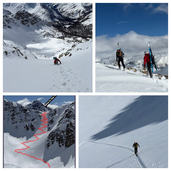
You can take scouting photos with Veezer for future use, without worrying about referencing; photos of the outing itself (to see your track, to share), and photos of the surrounding slopes for future outings.
After the Outing
You can reference the Veezer photos taken during the outing: once warm at home, there’s no problem taking a control point; you can use map coordinates from a mapping app (map, panorama, 3D model, etc.) as a reference.
Photos taken in Veezer are easy to reference.
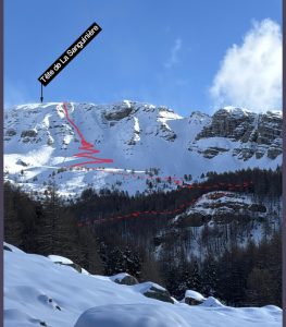
You can see your track on the different photos to analyze your outing or to share.
The prepared scouting photos can be shared with the community or kept for future outings 😊